Featuring
Pirganj at a glance
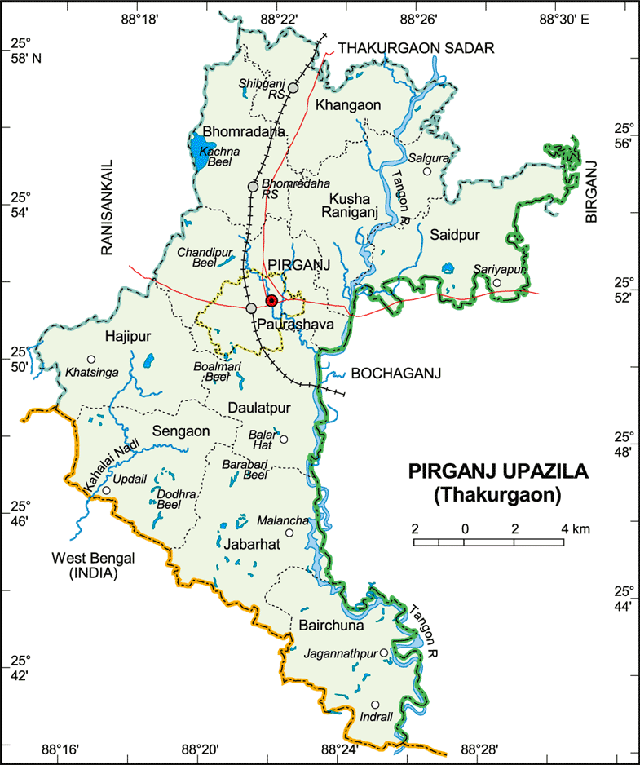
Pirganj Upazila, having an area of 87472.85 acre or 353.99 square kilometer, is located in between 25°40' and 25°59' north latitudes and in between 88°15' and 88°22' east longitudes.
The upazila is bounded by Thakurgaon Sadar Upazila on the north, Birganj and Bochaganj upazilas in Dinajpur District on the east, Kaliaganj and Hemtabad CD blocks in Uttar Dinajpur district, West Bengal, India, on the south and Ranisankail Upazila on the west.
Educational Institutions
- Pirganj Model Government Primary School
- Sobuj Government Primary School
- Pirganj Pilot High School
- Pirganj Banik Government Girls High School
- Pirganj Government College